Walking The Neath Canal at Glynneath by David J Sack.
All images copyright of Glynneath and Cwmgwrach Hiatorical Society unless otherwise stated.
The old canal bed can still be seen in Glynneath
•The Neath canal is 13.5 miles in length from Giants Grave to the Terminal Basin at Glynneath.
•In this talk we will look at the section through Glynneath with a few pictures of now and then.
•The following are distances between locks on the Neath Canal at Glynneath.
•Chain Road Lock No. 16 0.4 miles

•Pentremalwed Lock (Fox’s Lock) No, 17 0.24 miles
• Lamb and Flag Lock No. 18 0.17 miles
•Maesmarchog Lock No.19 0.25 miles
•Terminal Basin Glynneath 0.3 miles
The last locks on this stretch of canal have mostly gone but you can still see where they were.
•The Neath Canal has been a major feature of the Neath valley since opening in 1795.
A little bit of history 1795 – 1934
•Traffic on the Neath Canal increased from 1799 and reached an annual tonnage of 200,000 tons in the mid 1820’s and continued at this level up to the 1870‘s
•But there was now competition from the Vale of Neath Railway.
1795 – 1934
Most of the collieries in the Neath Valley transferred over to the railway and the canal fell into decline
By the start of the First World War, traffic had virtually ceased.
After the war, traffic was almost non-existent,
The last toll was taken in 1934.
I am going to use maps to illustrate the route then and now
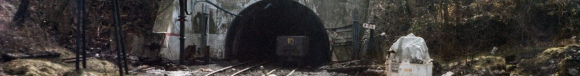
•So our journey begins by the Aberpergwm Pit and the Chain Road lock.
Lock 16 looks in remarkably good condition but it is difficult to access – picture taken August 2022
‘Reproduced with the permission of the National Library of Scotland’ Map Images website.

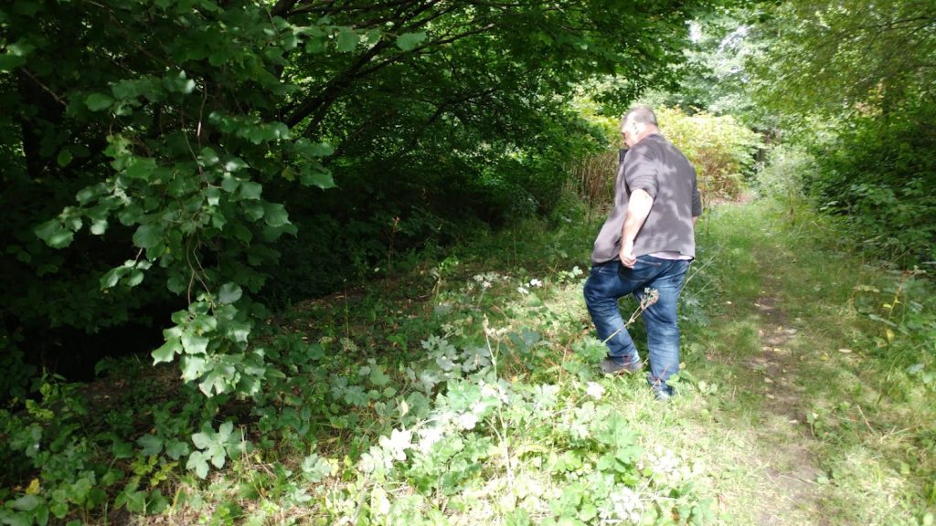
From Lock 16 we can follow the canal bed to Pentremalwed Lock (Fox’s Lock) – I am sure you all recognise this gateway to St Cadoc’s:

Today there is little left of lock 17 but the canal bed still leads towards ‘The Lamb and Flag’
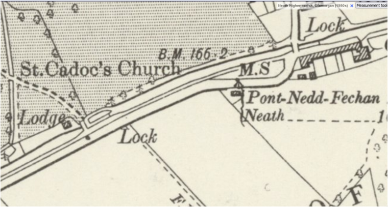
Reproduced with the permission of the National Library of Scotland’ Map Images website.
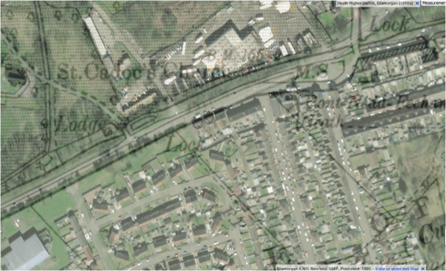
And this is where we can see how much has changed – compare with the 1970ish view.
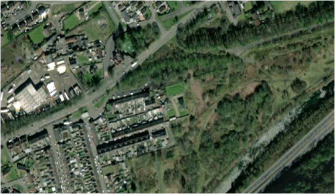
A superimposed image:
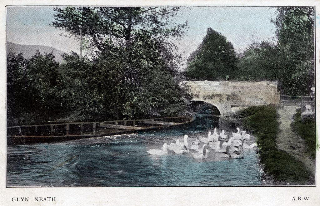
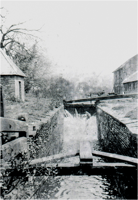
Lock 18 – by the Lamb and Flag


Lamb and Flag Lock No 18
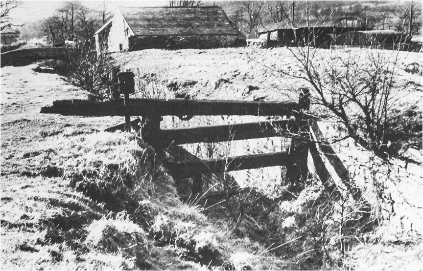
This image shows a functioning lock today this is buried.
The canal at the Lamb being filled
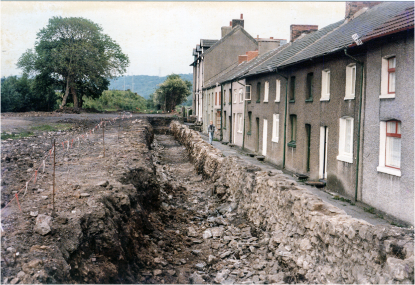
Now it has gone – but we can walk on.
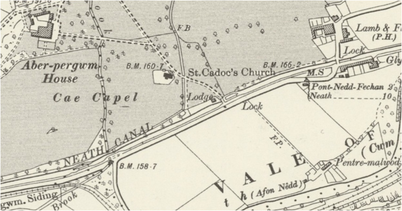
A little further along the remains of the canal bed continue to Maesmarchog Lock No 19

Reproduced with the permission of the National Library of Scotland’ Map Images website.
Today there is little to see but we have a very good photo from back in the day
We can follow the bed of the canal a little further but the final part now lies under the A465.
Some intriguing clues remain for those who do not know the history,
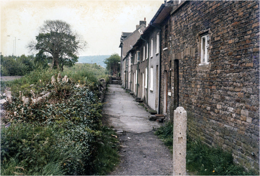
For example the ‘Canal Cottages’ with no canal in sight !
Our merged maps show where the wharf was located.
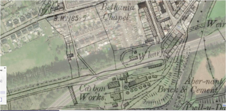
Canals End Glynneath
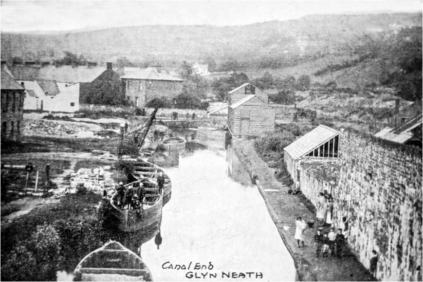
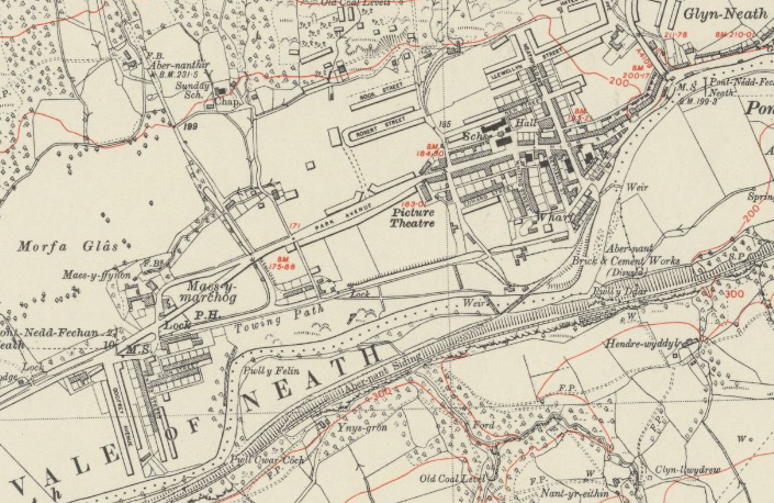
Reproduced with the permission of the National Library of Scotland’ Map Images website.


I hope you enjoyed our journey – Thank You.
Please visit and support Neath & Tennant Canals Trust https://www.neath-tennant-canals.org.uk/
FurtherReading:
- The Canals of South Wales and The Border, Charles Hadfield, University of Wales Press
- Canals of the Welsh Valleys and their Tramroads, DD & JM Gladwin, The Oakwood Press
December 2023 Gynneath and Cwmgwrach Historical Society.